

A trusted data repository offering
free public access to a curated collection of marine geophysical
data and metadata related to the formation and evolution of the seafloor and sub-seafloor.
Explore our data holdings to discover research data from around the world.
Academic Seismic Portal
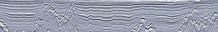
The primary data resource for
field and processed data from active source marine seismic experiments (multi-channel, single-channel, chirp subbottom, sonobuoy)
acquired by the U.S. academic community.

Submersible Data
Submersibles provide important high-resolution geophysical data sets as well as bottom samples, photos and video that
are important for seafloor characterization and ground-truth. Data have been acquired by the National Deep Submergence
Facility (NDSF), the Schmidt Ocean Institute (SOI), and the Monterey Bay Aquarium Research Institute (MBARI).

Related Resources
Data systems and tools that were formerly operated as part of IEDA continue to offer complementary data products and services, including:

Recent Citations
Wu et al., 2025,
Quantifying widespread hydrothermal chimneys on the East Pacific Rise flanks between 9°43′ and 57′N,
Sci. Adv., 11. doi: 10.1126/sciadv.adv0788.
Oliver-Serra et al., 2025,
Pollution Simulations and in-Field Measurements Performed in March at Longyearbyen, Spitzbergen,
Conf. Proc., 353–360. doi: 10.1007/978-3-031-97635-3_42.
Hippolyte and Mann, 2025,
Polyphase Tectonic Evolution of the Puerto Rico-Virgin Islands Microplate Revealed by Fault-Slip Data and Stress Inversions,
Geochem Geophys Geosyst, 26. doi: 10.1029/2025GC012227.
Baranov and Andreeva, 2025,
Seismicity of tectonic structures of the South Polar Region,
Journal of Mining Institute, 273, 42-51.
Wang and Muto, 2025,
Autogenic Curvature of Transgressive Shelf Profiles,
Geophysical Research Letters, 52. doi: 10.1029/2024GL114460.
Colet et al., 2025,
Active Crustal Deformation Across a Nucleating Extensional Microplate, D. R. Congo, East Africa,
Tectonics, 44. doi: 10.1029/2025TC008815.
Kyritz et al., 2025,
Examining Controls on Fluid Overpressure in Buried Basement Highs of Oceanic Crust: Implications for Permeability of the Astoria Fan,
Geochem Geophys Geosyst, 26. doi: 10.1029/2025GC012248.
Barreyre et al., 2025,
Hydrothermal vent temperatures track magmatic inflation and forecast eruptions at the East Pacific Rise, 9°50’N,
PNAS, 122. doi: 10.1073/pnas.2510245122.
Civile et al., 2025,
Discovery of Cenozoic magmatic ridges and tectonics off northern Victoria Land provides new insights into the geodynamics of the Antarctic margin,
Sci Rep, 15. doi: 10.1038/s41598-025-06739-7.
